

Early Illinois Forest Resources
( This has been excerpted from "Forest Resources of Illinois, 2002" )
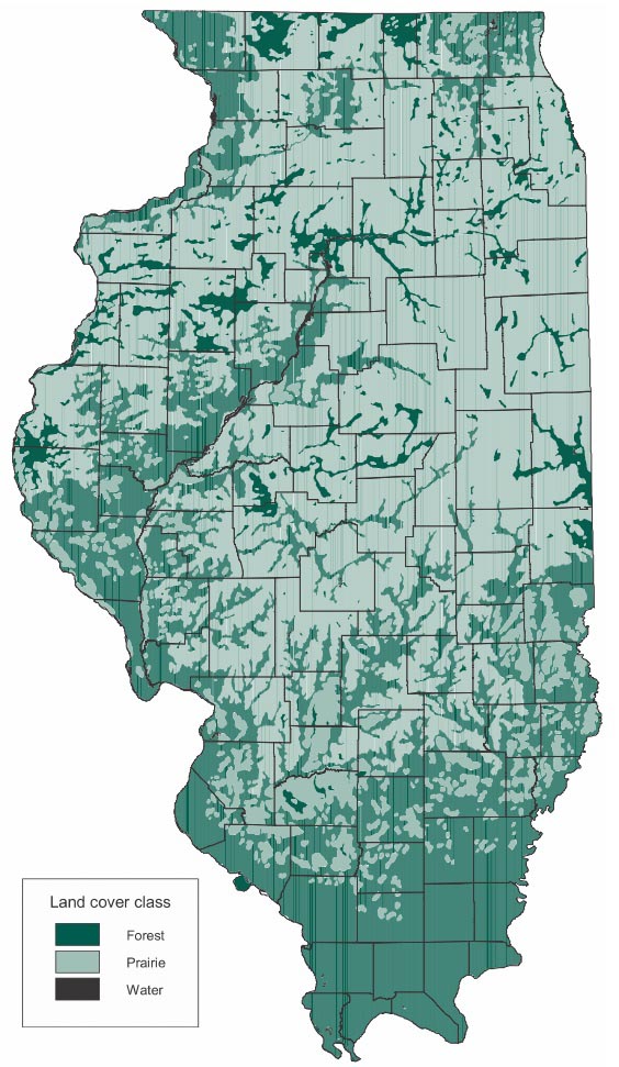
In 1970, R. C. Anderson used the original land survey records of Illinois to create a detailed map showing the original land cover in the early 1800s, when the state was settled. The Illinois Geographic Information System software was used to digitize this map and calculate acreages of forest, prairie, and water for individual counties (Table 1). The state totals show that prairie covered the largest area, with 21.6 million acres. Forests accounted for 13.8 million acres, and water for 0.2 million acres. The original forests of Illinois had an estimated volume of 16.3 billion cubic feet of sawtimber. Using the map and information generated from it, estimates for the regions and the counties can be made to show the general distribution of the forests in Illinois prior to settlement.
Compare this map to the satellite data of 2007. See how your county's estimated forest acreage compares to 1920 and today.

( This has been excerpted from "Forest Resources of Illinois, 2002" )
In 1970, R. C. Anderson used the original land survey records of Illinois to create a detailed map showing the original land cover in the early 1800s, when the state was settled. The Illinois Geographic Information System software was used to digitize this map and calculate acreages of forest, prairie, and water for individual counties (Table 1). The state totals show that prairie covered the largest area, with 21.6 million acres. Forests accounted for 13.8 million acres, and water for 0.2 million acres. The original forests of Illinois had an estimated volume of 16.3 billion cubic feet of sawtimber. Using the map and information generated from it, estimates for the regions and the counties can be made to show the general distribution of the forests in Illinois prior to settlement.
Compare this map to the satellite data of 2007. See how your county's estimated forest acreage compares to 1920 and today.